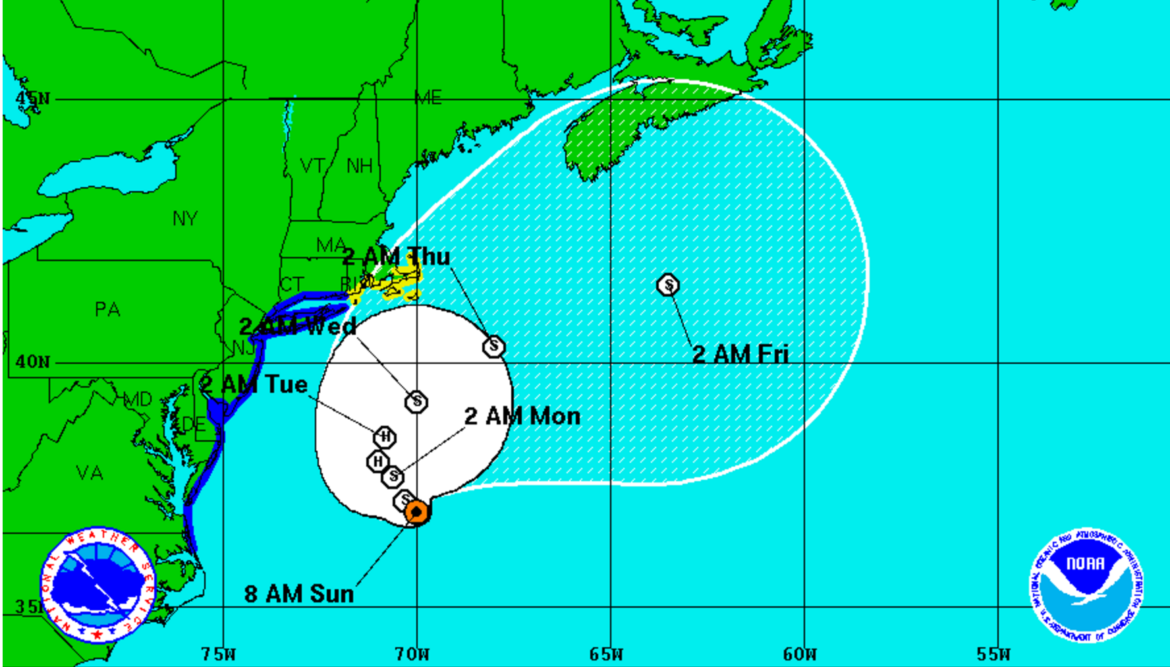
A National Weather Service map of the path of Hermine this week.
While it appears Watertown will not feel the wrath of Hermine, the former hurricane will still have a big impact on the weather this week as it parks off shore.
The storm is forecast to stay off the south coast of New England, and rain and thunderstorms are expected to start tonight and last through Wednesday.
The National Weather Service (NWS) forecast calls for rain to start after midnight tonight, and showers and possible heavy downpours are expected through Labor Day, with a chance of thunderstorms after 11 a.m.
Winds will not be too strong, with winds 14-18 mph through the next few days and gusts up to 28 mph, according to the NWS forecast. The Cape, Islands and south coast of New England, however, will get some storm impact.
In Watertown, the rain and thunderstorms continue Monday night and could continue through about 10 a.m. Tuesday. There is a chance of showers through Tuesday and possible thunderstorms in the early hours of Wednesday.
A chance of showers through 3 p.m. on Wednesday and the storm could still be felt through Wednesday night.