Department of Public Works
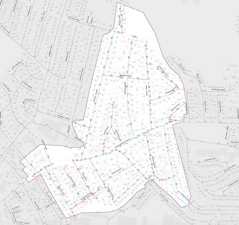
Areas off of Mt. Auburn Street (going left to right) just east of Watertown Square that will have sewers examined this year and repaired next year. Russell Avenue is the light blue road north of Mt. Auburn Street (top left of the white section), and Spruce Street is the light blue line on the right side of the bottom part of the map.
The Department of Public Works will begin a multi-year sewer project in two areas of town with the help of money provided by the MWRA.
The work begins with investigation of the sewer pipes under the streets using a camera that travels through the system searching for areas where pipes has been damaged, said Dennis Sheehan, the DPW’s Director of Administration and Finance. The pipes will also be cleaned.
Cracks and damage can allow sewage out but also allows water into the pipes, which ultimately costs the town more money, Sheehan said.
“The goal of the program is to reduce the amount of clean water being diverted to Deer Island and prevent the town paying (the treatment of) ground water infiltrating into the system,” Sheehan said.
Next year, the DPW will repair the damages areas found by the cameras this year.
The project will be paid for with a grant from the MWRA (Metropolitan Water Resources Authority), including $524,000 from the Inflow and Infiltration Local Financial Assistance Program and $478,000 in interest free loans from the MWRA’s Local Water System Program.
Department of Public WOks
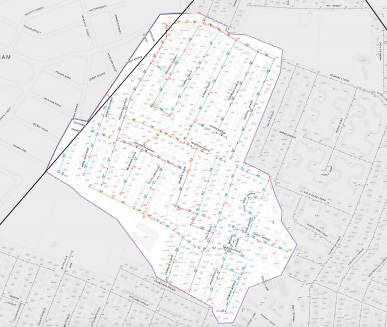
The area on the west side of town where the two year sewer repair project will occur. The area is east of the Waltham line, south of Belmont Street and goes down to Warren Street and the eastern border is Sparkill Street (in green), Rose Avenue (with the U in the middle) and Desmond Avenue (in blue on the bottom right).
Next year, the town will get even more grant money, Sheehan said. This year the grant pays for 55 percent of the work, and next year it will pay for 75 percent.
The three areas of town where the work will occur are:
• North of Mt. Auburn Street, south of the Oakley Country Club; and east of and including Russell Avenue and west of but not including Stearns Road
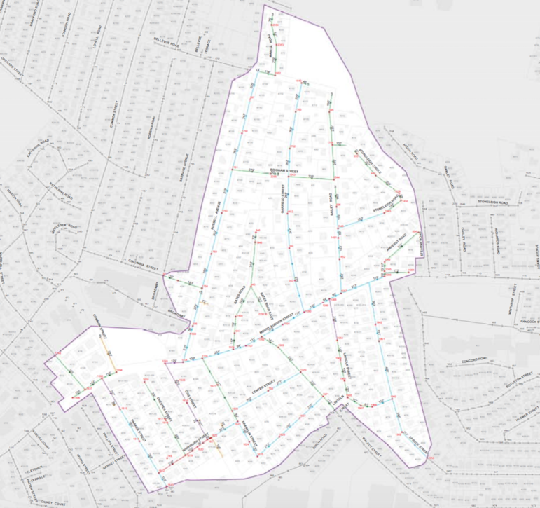
• South of Mt. Auburn Street down to, and including Washburn Street and Franklin Street; as well as Lincoln Street, and the sections of Walnut and Spruce streets closest to Mt. Auburn Street.
• South of Belmont Street (from the Waltham line to Sparkill Street) to Warren Street (from the Waltham line to Desmond Avenue) and also including the roads between Warren Street down to, but not including, Grandview Avenue; East from Waltham line up to and including Sparkill Street, Rose Avenue and Desmond Avenue on the eastern edge of the area.
(See the maps for more details)