Charlie Breitrose
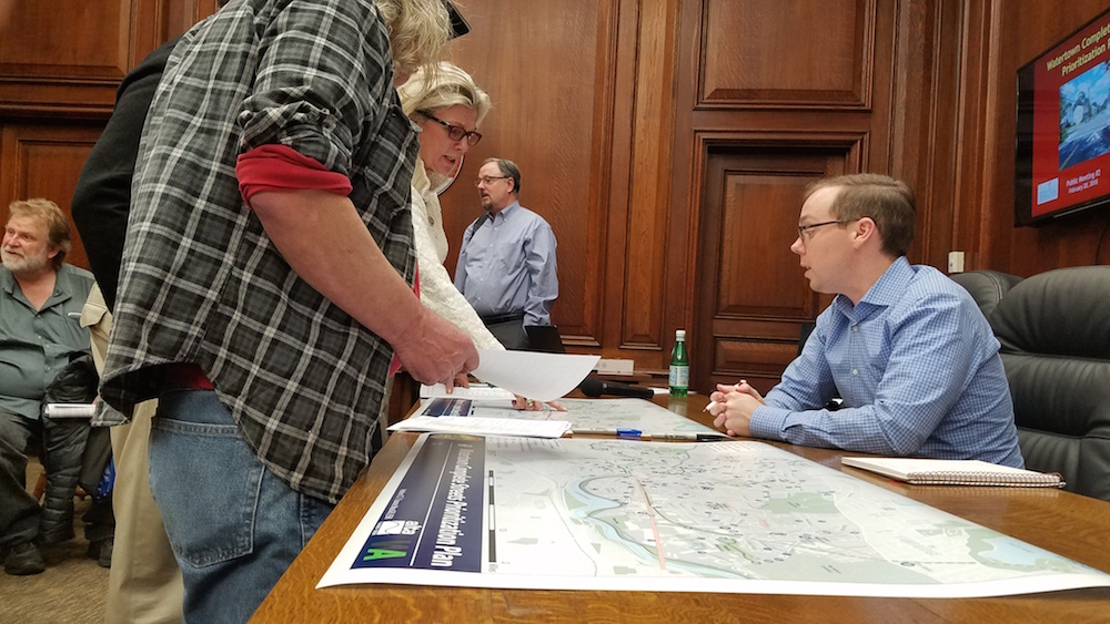
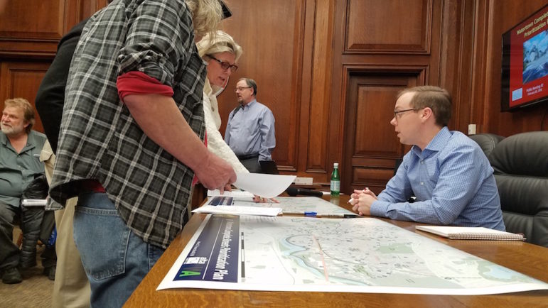
Consultant Charlie Creagh from Alta Planning + Design shows a map of the proposed Complete Streets projects to residents Wednesday night.
A variety of projects – from the Community Path to crosswalks to traffic calming – made the first cut in the creation of Watertown’s Complete Streets Prioritization Plan. Town officials, however, still seek input about which should make the final list of 15-20 projects.
Wednesday night, consultants hired by the town to create the Prioritization Plan discussed why some of the projects made the grade and others did not. The town will be able to apply for funding from the Mass. Department of Transportation (MassDOT) for projects on the Prioritization Plan.
Complete Streets are ones that are safe, comfortable and convenient for a variety of types of travel (motor vehicles, public transit, bicycling and walkers). They are also accessible to people of all ages and abilities, said consultant Phil Goff, senior planning associate with Alta Planning + Design.
The projects were chosen from suggestions from more than 50 people who came to the first Complete Streets meeting in December and comments submitted by 146 people who filled out online surveys. The Consultants also spoke with people at the Senior Center’s Monthly Coffee with the Police Chief, the Watertown Commission on Disabilities, the Bicycle & Pedestrian Committee and with Live Well Watertown.
The issues people most frequently brought up were traffic speed, pedestrian safety, Arsenal Street, Belmont Street, adding sidewalks, and more connections to the Charles River, Goff said.
The consultants worked with the Department of Public Works to give points to each of the projects based on five factors: safety, connectivity, proximity to schools, potential use, and impact on vehicular operation. Each project was given up to five points in each of these factors, though DPW’s Town Engineer Matt Shuman said the points were altered for impact on vehicle operation. That was graded from negative 2 to plus 2 points so that a project that has no direct link to a roadway does not get 0 out of 5, and reduce the number of total points more severely just because traffic does is not a factor in the project.
Preliminary List
The initial list was pared down significantly, said Charlie Creagh, a consultant with Alta. Fifty-five were on Department of Conservation and Recreation land, which is owned by the state, not the town. Another 35 were moved onto the DPW’s list of potential road and sidewalk improvement projects. The remaining suggestions had some overlap, so they were whittled to 65.
Goff said there were 34 projects that got the most points, and the broke down into the following:
- 4 Corridor wide (such as Mt. Auburn Street)
- 8 Crossing improvements
- 5 Safe access to schools
- 7 Shared use paths
- 7 Traffic calming
- 2 Bicycle facilites
Some residents at the meeting wanted to know more about the point system and how they were determined. Goff said a full spreadsheet of the points for each project will be available on the Town’s website, along with the list of all projects and a map showing where each is located.
The numbers of projects in each category can be misleading, Creagh said.
“We took, maybe, 10 or 11 suggestions for a bike path and combined it into one,” Creagh said. “That is why there are fewer bike recommendations.”
Resident and former Town Councilor Aaron Dushku said he was happy to see the completion of the Community Path, especially between Irving Street and Main Street, on the list.
The list includes major corridors including Arsenal Street and Mt. Auburn Street, but Town Council President Mark Sideris said he had hoped to see projects in areas that have not gotten a lot of attention.
“I can’t remember the last time we did improvements on Highland (Avenue),” Sideris said. “Start moving up areas that have not been on the list of areas that we have invested money into.”
Shuman said they put some of the big projects already in the works on the list because it shows the state that these are important areas for the town.
Resident Joe Levendusky said he wants to see the Town take a more broad look at traffic patterns and travel modes because he believes they can be improved and have traffic move more smoothly.
“We need lower peak speeds (for traffic) and higher average speeds,” Levendusky said.
What’s Next
Over the next few months, consultants will work with staff from the DPW and the Department of Community Development and Planning to come up with a list of 15-20 projects to be on the final Complete Street Prioritization Plan.
“Technically there is no limit (on the number) but you don’t want to water it down,” Creagh said. “You want to make sure they are funded by MassDOT.”
Watertown will be able to apply for up to $400,000 in funding each year for five years to fund projects on the Prioritization Plan, said consultant David Watson, principal of WatsonActive – which is working with Alta. Each year the can apply for up to five projects. Town officials will decide which projects for which to apply for funding.
The plan must be approved by the Town Council, and will likely be discussed by the Public Works subcommittee before going for final approval. There will be opportunity for public input at those meetings.
Town Wants to Know What Changes You’d Make to Streets in Your Neighborhood