By Linda Scott
Watertown Resident
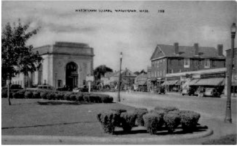
Part 9: There’s a New Bridge in Town
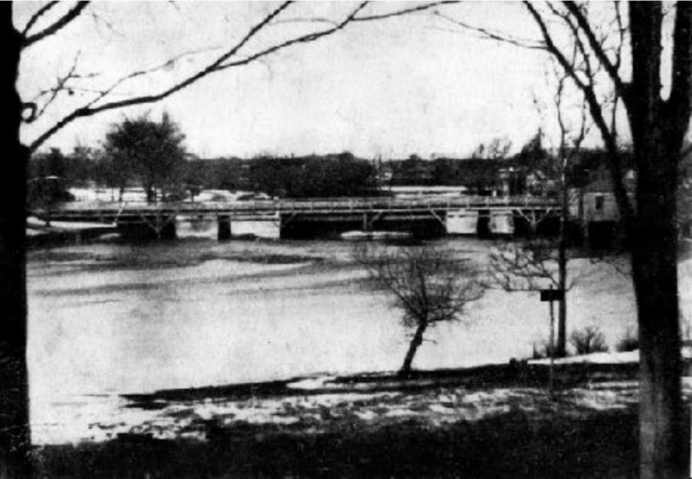
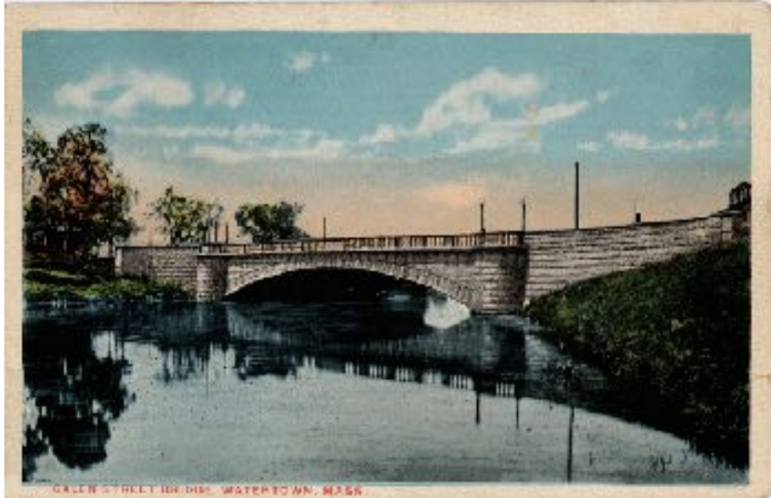
According to Maud Hodges, in Crossroads on the Charles: “The new bridge was designed by Wilbur Learned, the Town engineer, and it combined strength, utility and beauty. The new structure was a broad, wide arch of concrete with a ninety-foot span …. The bridge was faced with granite blocks cut in Deer Isle, Maine. The road bed was 80 feet wide, spreading out at both ends to provide access for vehicles. Mt. Auburn Street was extended to meet it.”
It was the beginning of a radical new look for the Square.
I found further information in a Watertown Enterprise article dated December 15, 1905 entitled: “New Plans for Bridge.”
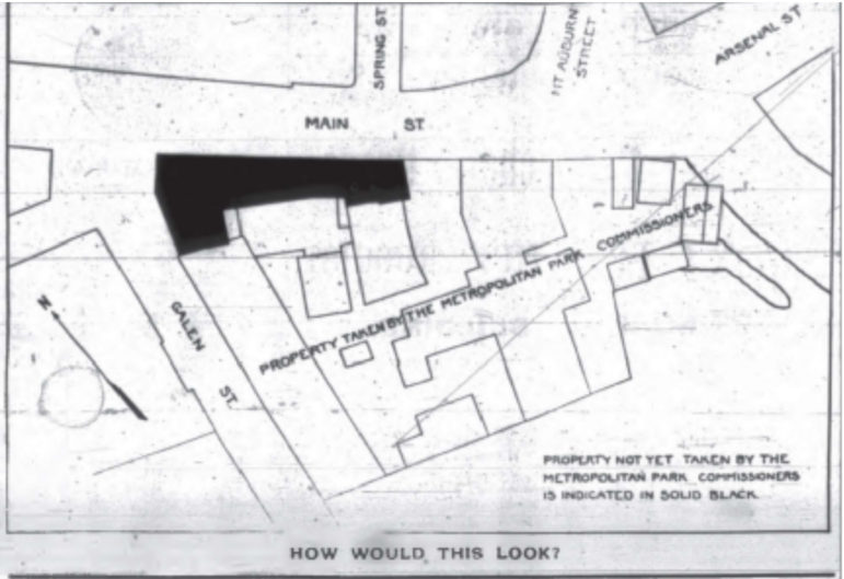
In the article, it explains that the Metropolitan Park Commission would like to keep the bridge entrance on the south side of the river at Galen Street in the same place, extend Mt Auburn Street to the Charles River and have the other side of the bridge meet Mt. Auburn Street. That way it would be “Relieving Watertown Square somewhat of its congestion.” To do this, the town would have to buy all of the buildings on the Delta, take them down and possibly leave a park there. They describe the Delta area as a “small triangle.”
As it turns out, the State bought the land to improve it. According to the Metropolitan Park Report of 1889, the State purchased the Walker and Pratt buildings and land for $105,183.00. Remember, this was just one of the properties on the Delta and in Watertown that needed to be acquired. The Watertown portion of this project alone was very expensive!
Burke mentions that Watertown got “park fever” and bought extra parkland, like Saltonstall and Whitney Woods, but when it came time to improve them, no action was taken.
He mentions that the Watertown Young Men’s Assembly (a sort of Chamber of Commerce of that time) was so inspired by this movement, they wrote a publication called “The Ideal Watertown” in 1898 with a very progressive vision for change. Here’s their take on Town improvement:
https://content.civicplus.com/api/assets/8288cf68-4e1f-46e0-af80-2e4c1d72222e?
Here’s a picture of how they envisioned the Delta being developed. Note that the dark part (part of Barnard Block and the grist mill) would remain.
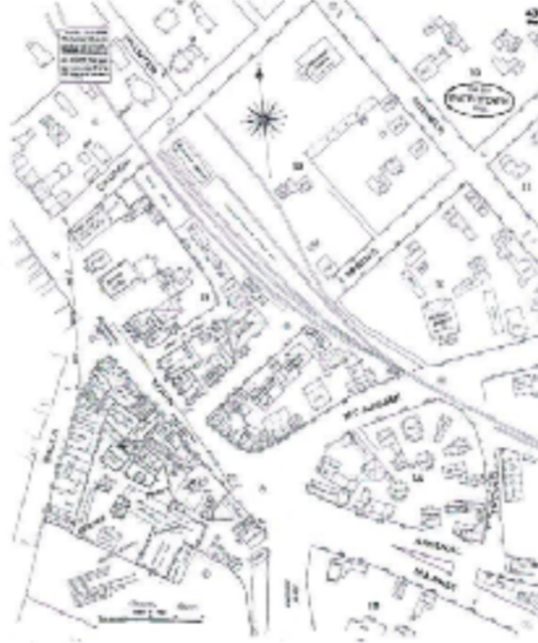
Notice that our Delta (bottom left on map) was filled with buildings and businesses.
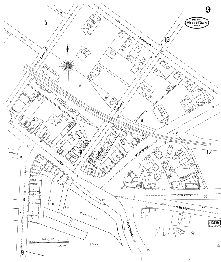
Notice how much land was cleared, but a portion of the buildings on Main and all of the buildings on Galen Street remained.
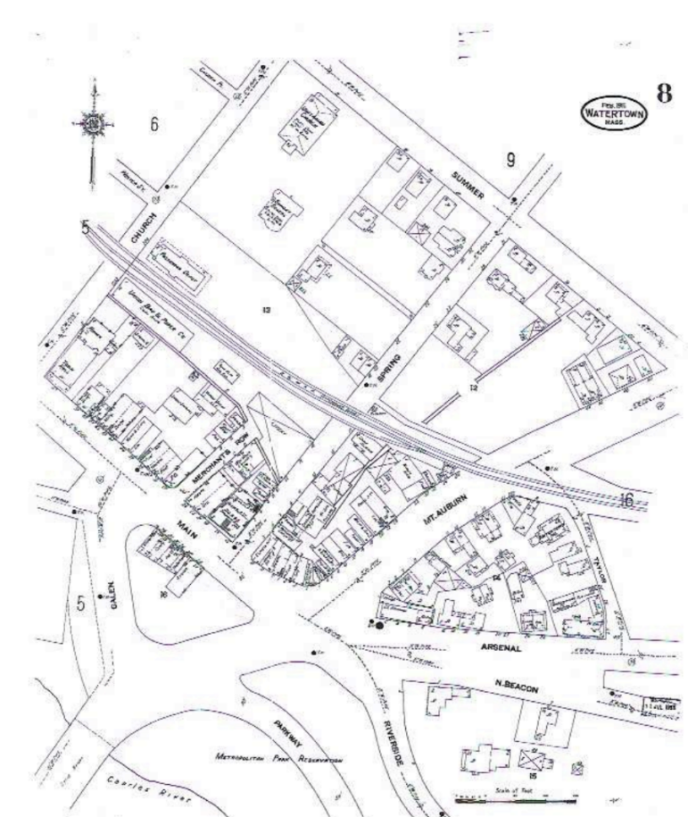
Notice the buildings that are left, including the grist mill. They’ll be torn down by 1925.
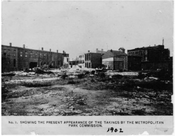
And here’s a picture of the destruction of the part of the Square called “Beacon Square.”
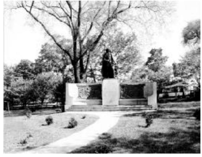
The only big plan of the Young Men’s Assembly to come true was clearing off the Delta. There was a proposal to put a memorial to the Founders in that space, but it was decided to keep the Delta open space. The monument was put on Charles River Road instead.
The Delta will have a bit of an argument attached to it. It seems, according to Burke, there was a political faction in Watertown that wanted a bus shelter to be placed on the Delta. Watertown was sticking to the agreement not to have anything but the flagpole on the property.
A group of businessmen had bought the remaining buildings left behind on the Delta with the idea that when the Town was ready to buy them, they would sell them to the Town at cost, not including interest.
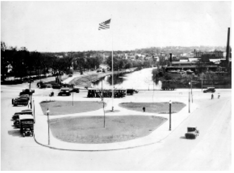
The buildings were bought by the Town in 1924 and demolished in 1925. This enlarged the Delta. The Delta was dedicated in May of 1927. Below is what it looked like on that day in 1927. You can almost see the three saplings. They’ve grown a bit since then!
The Metropolitan Park Commission deeded the Delta back to Watertown on the condition that no structure or building would be placed there other than a flagpole. If anything was, the State had a right to reclaim the land.
In 1939, a Town Meeting vote of 85 to 59 named the Delta “Columbus Delta,” and in 1940 the Knights of Columbus stone marker was installed.
According to Burke, “The ‘Shelter in the Delta’ faction persisted, and a shelter for streetcar patrons was eventually built in 1947.”
Next: Part 10: Change is inevitable, but Growth is Optional